Archive for January, 2013
Aloha!
by StreetViewFun.com on Jan.24, 2013, under 3D Models, Argentina, Australia, Brazil, California, Denmark, England, Germany, Google Earth News, Google Earth Tips, Google Sky, Google maps, Hawaii, Indonesia, Ireland, Italy, Japan, Kenya, Mexico, Natural Landmarks, Netherlands, Sightseeing, Street Views, USA
Comments Off :funny street view more...
Check out this crazy guy
by StreetViewFun.com on Jan.23, 2013, under 3D Models, Argentina, Australia, Brazil, California, Denmark, England, Germany, Google Earth News, Google Earth Tips, Google Sky, Google maps, Hawaii, Indonesia, Ireland, Italy, Japan, Kenya, Mexico, Natural Landmarks, Netherlands, Sightseeing, Street Views, USA
Comments Off :Canada, funny street view, greeting more...

Finding “nail houses” in Google Earth
by Google Earth Blog on Jan.23, 2013, under 3D Models, Argentina, Australia, Brazil, California, Denmark, England, Germany, Google Earth News, Google Earth Tips, Google Sky, Google maps, Hawaii, Indonesia, Ireland, Italy, Japan, Kenya, Mexico, Natural Landmarks, Netherlands, Sightseeing, Street Views, USA
Nail houses are an interesting phenomenon, where homeowners refuse to sell their house/land to development companies and the company simply builds their new development around their house. They tend to be most common in China, but can occur in many different countries. The Disney/Pixar film "UP" featured Carl Fredricksen in his nail house before he attached the balloons and took off on his adventures with Russell.

The most famous real-life example of a nail house is probably the home in Chongqing, China, shown here, where the homeowner held out for nearly three years before finally selling to contractors:

Stefan Geens at Ogle Earth recently wrote an excellent article about nail houses in China, with geospatial references whenever possible. He covers a variety of nail houses in China in recent years (including the Chongqing house) and includes a nice KMZ file to help you find them all.
As he points out, Google Earth's historical imagery tool can be quite useful when viewing the before/after of these various situations. I recommend you read his entire article to learn more.
Update: For more nail houses, check out this post from a few years ago on Google Sightseeing.
Something wrong with your pizza delivery?
by StreetViewFun.com on Jan.23, 2013, under 3D Models, Argentina, Australia, Brazil, California, Denmark, England, Germany, Google Earth News, Google Earth Tips, Google Sky, Google maps, Hawaii, Indonesia, Ireland, Italy, Japan, Kenya, Mexico, Natural Landmarks, Netherlands, Sightseeing, Street Views, USA
Comments Off :funny street view more...

Are these animals dangerous?
by blupf23 on Jan.23, 2013, under 3D Models, Argentina, Australia, Brazil, California, Denmark, England, Germany, Google Earth News, Google Earth Tips, Google Sky, Google maps, Hawaii, Indonesia, Ireland, Italy, Japan, Kenya, Mexico, Natural Landmarks, Netherlands, Sightseeing, Street Views, USA
Comments Off :Animals, Cam errors, Croatia, funny street view more...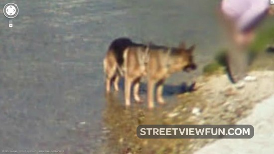
Lamp on the head!!
by kar.haim on Jan.22, 2013, under 3D Models, Argentina, Australia, Brazil, California, Denmark, England, Germany, Google Earth News, Google Earth Tips, Google Sky, Google maps, Hawaii, Indonesia, Ireland, Italy, Japan, Kenya, Mexico, Natural Landmarks, Netherlands, Sightseeing, Street Views, USA
Comments Off :funny street view, Israel, lamp, rehovot more...
NASA’s Landsat 8 satellite to launch on February 11
by Google Earth Blog on Jan.22, 2013, under 3D Models, Argentina, Australia, Brazil, California, Denmark, England, Germany, Google Earth News, Google Earth Tips, Google Sky, Google maps, Hawaii, Indonesia, Ireland, Italy, Japan, Kenya, Mexico, Natural Landmarks, Netherlands, Sightseeing, Street Views, USA
NASA is set to launch the Landsat 8 satellite on February 11, the latest in their ongoing Landsat Data Continuity Mission (LDCM). This launch is exciting as this will be one of the best image-capturing satellites in space, anticipated to collect over 400 images per day.

From their press release:
After launch, LDCM will enter a polar orbit, circling the Earth about 14 times daily from an altitude of 438 miles (705 kilometers), returning over each location on Earth every 16 days. After launch and the initial checkout phase, the USGS will take operational control of the satellite, and LDCM will be renamed Landsat 8. Data will be downlinked to three ground stations in Gilmore Creek, Alaska; Svalbard, Norway; and Sioux Falls, S.D. The data will be archived and distributed at no cost to users from the USGS's Earth Resources Observation and Science Center in Sioux Falls.
"LDCM will be the best Landsat satellite yet launched in terms of the quality and quantity of the data collected by the LDCM sensors," said Jim Irons, LDCM project scientist at Goddard. "OLI and TIRS both employ technological advances that will make the observations more sensitive to the variation across the landscape and to changes in the land surface over time."
Irons also said that he expects that about 90 days post-launch that NASA will have operational data. "A first light image will come 23 days post-launch; 60 days after launch there will be a first look with some calibration," said Irons.
You can learn more about this launch from this article on DirectionsMag or by reading NASA's NDCM Brochure (PDF).
Dog keeping an eye on Google while owner is filching roses
by StreetViewFun.com on Jan.22, 2013, under 3D Models, Argentina, Australia, Brazil, California, Denmark, England, Germany, Google Earth News, Google Earth Tips, Google Sky, Google maps, Hawaii, Indonesia, Ireland, Italy, Japan, Kenya, Mexico, Natural Landmarks, Netherlands, Sightseeing, Street Views, USA
Comments Off :Animals, funny street view more...
Chase between google cars in Italy
by StreetViewFun.com on Jan.22, 2013, under 3D Models, Argentina, Australia, Brazil, California, Denmark, England, Germany, Google Earth News, Google Earth Tips, Google Sky, Google maps, Hawaii, Indonesia, Ireland, Italy, Japan, Kenya, Mexico, Natural Landmarks, Netherlands, Sightseeing, Street Views, USA
Comments Off :funny street view, Google car and crew more...
Internet addiction
by fisgonmorboson on Jan.22, 2013, under 3D Models, Argentina, Australia, Brazil, California, Denmark, England, Germany, Google Earth News, Google Earth Tips, Google Sky, Google maps, Hawaii, Indonesia, Ireland, Italy, Japan, Kenya, Mexico, Natural Landmarks, Netherlands, Sightseeing, Street Views, USA
Comments Off :funny street view, People, Thailand more...